Hobie Forums http://www.hobie.com/au/en/forums/ |
|
Maine Island Trail http://www.hobie.com/au/en/forums/viewtopic.php?f=70&t=60352 |
Page 1 of 4 |
Author: | BobAgain [ Thu Apr 20, 2017 11:49 pm ] |
Post subject: | Maine Island Trail |
I've joined the Maine Island Trail Association and am now starting to plan my TI exploration for this August/September. I'll be doing it in stages - park somewhere and head a few days north/a few days south and then back. Any words of wisdom? I'll also be taking the TI up to Nova Scotia to explore the Bras D'Or. Anyone ever cross the US/Canada border with their boat? I'll be doing a thorough clean before heading north from Florida but I wonder what other prep I'll need to do. |
Author: | Chekika [ Fri Apr 21, 2017 11:20 am ] |
Post subject: | Re: Maine Island Trail |
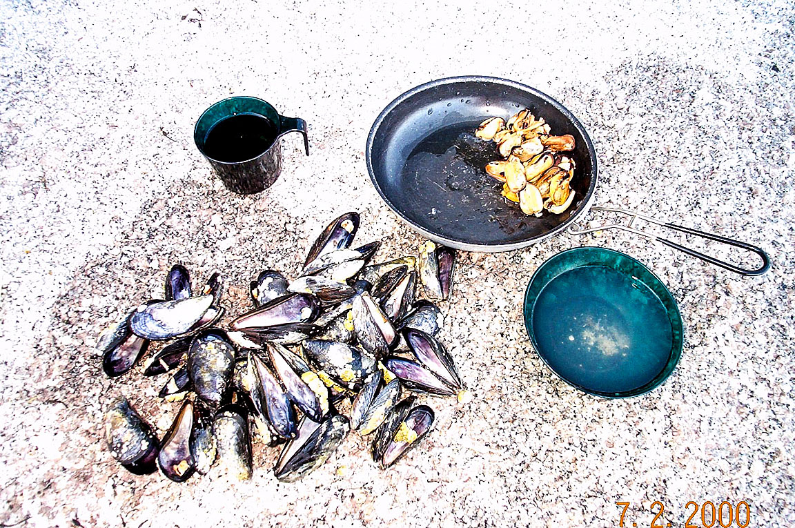
Wow, Bob, that is going to be an adventure! 1. Have good charts of the area. Have a good chart on your GPS if possible. 2. There are rocks and boulders everywhere, above and below water. Be careful. 3. Lobster fishermen--kayaks and Islands are speed bumps to them. Their boats have very high bows--they literally can not see you when you are directly in front of them. Stay out of their path. 4. Water temps probably about 55 deg. Not too bad, but a dry suit would be smart. 5. Absolutely keep your tent poles dry or they will freeze up. 5. Mussels and clams can make for some good eating along the way. You will sometimes see clam diggers working on shore. They will usually give you a good deal on a bucket of clams. 6. Old Quarry Ocean Adventures near Stonington is a good place to camp and launch from. http://www.oldquarry.com/ Good luck! Keith PS Write your adventures up on my "Expeditions" thread. |
Author: | BobAgain [ Fri Apr 21, 2017 8:08 pm ] |
Post subject: | Re: Maine Island Trail |
Chekika wrote: Wow, Bob, that is going to be an adventure! 1. Have good charts of the area. Have a good chart on your GPS if possible. 2. There are rocks and boulders everywhere, above and below water. Be careful. 3. Lobster fishermen--kayaks and Islands are speed bumps to them. Their boats have very high bows--they literally can not see you when you are directly in front of them. Stay out of their path. 4. Water temps probably about 55 deg. Not too bad, but a dry suit would be smart. 5. Absolutely keep your tent poles dry or they will freeze up. 5. Mussels and clams can make for some good eating along the way. You will sometimes see clam diggers working on shore. They will usually give you a good deal on a bucket of clams. 6. Old Quarry Ocean Adventures near Stonington is a good place to camp and launch from. http://www.oldquarry.com/ Good luck! Keith PS Write your adventures up on my "Expeditions" thread. Thanks, Keith. I plan to take LOTS of photos. MITA has an app that I'm working to download onto my computer in order to work from a bigger screen - gonna put it on my phone, too, for general help while I'm sailing. The large tidal changes have me wondering about how to anchor and beach the boat for the night. Rocky shores will be a new adventure. The Moss tent will be just the thing for a nice snug sleep. THanks!! |
Author: | Chekika [ Fri Apr 21, 2017 8:57 pm ] |
Post subject: | Re: Maine Island Trail |
There are some protected sandy coves among the boulders and beaches on the islands, but, you may be getting up in the middle of the night to move your boat higher. Carry long bow lines and a good anchor. Keith |
Author: | dougDNer [ Fri Apr 28, 2017 1:35 pm ] |
Post subject: | Re: Maine Island Trail |
Hi Bob, I have some experience in that neck of the woods. Contact me by email. |
Author: | CaptnChaos [ Mon Jun 12, 2017 5:36 am ] |
Post subject: | Re: Maine Island Trail |
Chekika wrote: 5. Absolutely keep your tent poles dry or they will freeze up. [/url] Hi Keith, This doesn't relate to camping in summer (end of July) does it? Somebody else suggested (offline) to completely cover tents in 4 mil plastic which I don't understand. Maybe I've been living in Florida too long. Jim |
Author: | Chekika [ Mon Jun 12, 2017 7:01 am ] |
Post subject: | Re: Maine Island Trail |
When we did our sea kayak camping up there, I got the poles slightly wet with sea water. Brought them back to Miami, left them extended, and the next time I went to use them they were corroded and "frozen" together. After that, I simply learned to keep them dry, AND, don't leave them extended. No, if you have a good tent, no need to put any plastic over it. Keith |
Author: | bedmonds [ Thu Aug 03, 2017 5:43 pm ] |
Post subject: | Re: Maine Island Trail |
Well Bob and Jim got to see it up here for real! Word has it that Bob rented a joint in Belfast for a month!! We're gonna sail on Saturday again with him and will give a Proof of life pic!! Sent from my Z958 using Tapatalk |
Author: | CaptnChaos [ Sat Aug 05, 2017 2:18 pm ] |
Post subject: | Re: Maine Island Trail |
We fell in love with Maine and were glad we dragged our TI 4000 plus miles to do some sailing there. This is now my favorite place in the US outside of Florida. It was great meeting Bryan and his wife Darla and Doug and Richard. There really is something special about people who own Islands. It's not every day you can sail with (Bryan) F16 pilots : ) Bob, Sue, my wife Yvonne and I had the pleasure of sailing with this group who had local knowledge of the area. That made it fun as well as educational, especially with the large tides and rocky areas. I didn't get too many pictures but here's a few I'll share. ![]() Bryan, Darla and Bob and Sue ![]() Doug - His car broke down here on his way to Canada 40 years ago and he never left ![]() Lobster boats, lobster traps and Lobster restaurants everywhere ![]() Getting the TI ready ![]() Lunch time ![]() Bob watching his TI start to float with the fast incoming tide ![]() Charging unit (solar) discussion to power electronics on the TI ![]() Beautiful Jim |
Author: | Chekika [ Thu Aug 10, 2017 9:28 pm ] |
Post subject: | Re: Maine Island Trail |
Hey, that looks like great fun. Reminds me of when we were there about 20 yrs ago...sea kayaking, of course. Keith |
Author: | Chekika [ Fri Aug 11, 2017 3:37 pm ] |
Post subject: | Re: Maine Island Trail |
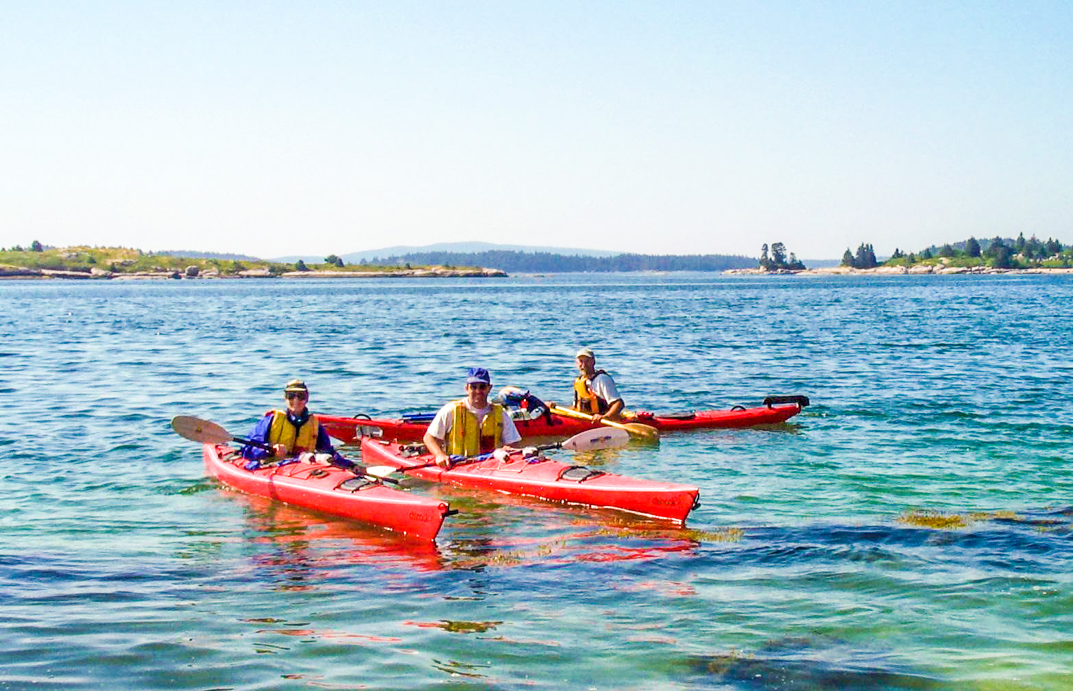
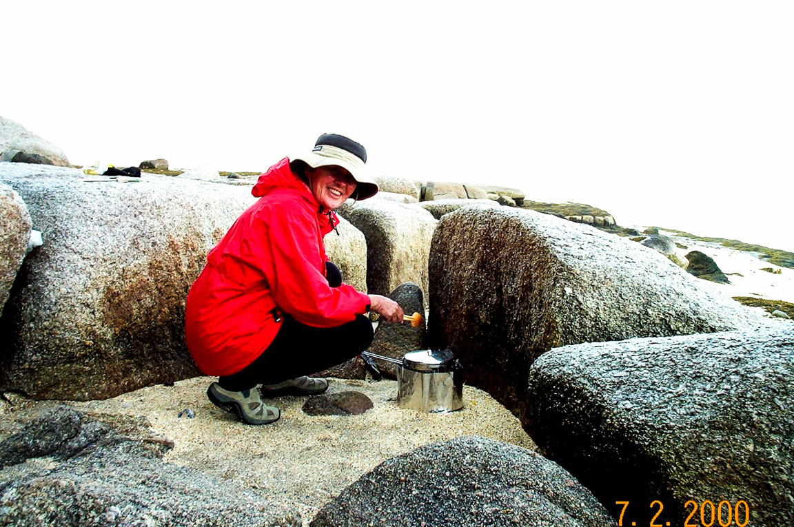
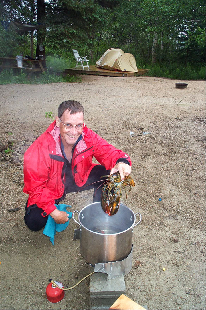
Reminiscing about Maine We did a couple trips to Maine…wonderful trips. They were our first “cold water” paddling. Their purpose was to prepare us for kayaking in Alaska. The water temperature in Maine those summers was about 55 deg F. While that was cool for us, it really did not prepare us for Alaska where the water temperatures were more like 37-39 deg F. Never the less, we loved Maine. Here are a few pictures. Out of Stonington ![]() Nancy doing a little cooking on the “beach.” ![]() We were always on the lookout for mollusks from the sea. ![]() Back at Stonington, I’m about to cook a lobster… ![]() Can you believe it, that was about 17 yrs ago!!! Keith PS @ Bob Smith--Bob, if you are reading this, do you recognize your tent in that last picture? |
Author: | CaptnChaos [ Sat Aug 12, 2017 7:32 am ] |
Post subject: | Re: Maine Island Trail |
Nice Pictures Keith ! It's amazing how quickly time flies. Bob told me he was in Stonington last week at the place where you camped. Yesterday he got back from camping on one of the islands and had an interesting time. It was actually pretty close to where you and Nancy were camping by Stonington. Here's a recap of Bob's Maine island camping adventure: "I sailed from Belfast out to Butter Island on Wednesday. The wind was blowing about 15 to 20 miles an hour once I got out there Butter Island was a fantastic place to Camp. I stayed two nights. My initial plan was to continue on to Merchants row but because my phone drowned I had to come back to Belfast to replace it. I'm planning to go back out again tomorrow. It took me seven and a half hours of beating up wind to sail from Belfast to butter. My Lowrance said I went 17 miles but I don't think it's counting all of the vertical up and down of the waves. Personally I believe that I sailed about 40 miles. Even sailing back yesterday pushed off about 10:45 and there was almost no wind. I was making about 2 miles an hour until I got closer to the Northern end of islesboro. At that point when I came around the point the Southwest wind blowing up Penobscot Bay was probably turning another 2 to 4 foot set of waves and 15 mile an hour winds or more - there were white caps. Yes I did use my motor both days on the way there I had the motor on I was pedaling and the sail of course. I was also hugging the side of islesboro in order to try and stay out of the wind as much as I could until I made the Crossing from islesboro over to the islands. That night I was so tired I could barely struggle up the beach but there were four kayak campers who were also there and came down to helped me. Ironically I ended up taking the amas off the boat for the first time so that I could carry them up above the high-water line. I used my beach Wheels underneath the Hull after I pumped out what seemed like gallon after gallon of water. The beach at Orchard Beach is quite steep towards the top. The other Beach and camping area on Butter Island is Nubble and it's beach is much gentler. I continue to be amazed at the spirit of our fellow kayak and camping enthusiasts. Two couples in Sea Kayaks were also camping at Orchard Beach my first night there. Three of them had been School teachers and they decided in their forties to go back to medical school to become nurses. As with everyone else that I've met in Florida kayaking, they were truly friendly and helpful people. When I think of it, the TI has not only allowed me to have terrific adventures on the water, it's also put me in touch with a group of people that I probably would not have met otherwise. " Bob ![]() Jim |
Author: | bedmonds [ Sat Aug 12, 2017 4:25 pm ] |
Post subject: | Re: Maine Island Trail |
CaptnChaos wrote: Nice Pictures Keith ! It's amazing how quickly time flies. Bob told me he was in Stonington last week at the place where you camped. Yesterday he got back from camping on one of the islands and had an interesting time. It was actually pretty close to where you and Nancy were camping by Stonington. Here's a recap of Bob's Maine island camping adventure: This is such a great example of takes of the trail (the Maine Island Trail). We're so glad to hear such fun words from folks out of town! It was great to meet Bob n Jim n Yvonne n Susan. Good time. I write this note from Wheat on the deer Isle archipelago. Great sail and camp this week!! Out with our friends Dan and Louise, a couple we've been hobiesailcationing with the last 3 years!!"I sailed from Belfast out to Butter Island on Wednesday. The wind was blowing about 15 to 20 miles an hour once I got out there Butter Island was a fantastic place to Camp. I stayed two nights. My initial plan was to continue on to Merchants row but because my phone drowned I had to come back to Belfast to replace it. I'm planning to go back out again tomorrow. It took me seven and a half hours of beating up wind to sail from Belfast to butter. My Lowrance said I went 17 miles but I don't think it's counting all of the vertical up and down of the waves. Personally I believe that I sailed about 40 miles. Even sailing back yesterday pushed off about 10:45 and there was almost no wind. I was making about 2 miles an hour until I got closer to the Northern end of islesboro. At that point when I came around the point the Southwest wind blowing up Penobscot Bay was probably turning another 2 to 4 foot set of waves and 15 mile an hour winds or more - there were white caps. Yes I did use my motor both days on the way there I had the motor on I was pedaling and the sail of course. I was also hugging the side of islesboro in order to try and stay out of the wind as much as I could until I made the Crossing from islesboro over to the islands. That night I was so tired I could barely struggle up the beach but there were four kayak campers who were also there and came down to helped me. Ironically I ended up taking the amas off the boat for the first time so that I could carry them up above the high-water line. I used my beach Wheels underneath the Hull after I pumped out what seemed like gallon after gallon of water. The beach at Orchard Beach is quite steep towards the top. The other Beach and camping area on Butter Island is Nubble and it's beach is much gentler. I continue to be amazed at the spirit of our fellow kayak and camping enthusiasts. Two couples in Sea Kayaks were also camping at Orchard Beach my first night there. Three of them had been School teachers and they decided in their forties to go back to medical school to become nurses. As with everyone else that I've met in Florida kayaking, they were truly friendly and helpful people. When I think of it, the TI has not only allowed me to have terrific adventures on the water, it's also put me in touch with a group of people that I probably would not have met otherwise. " Bob ![]() Jim Maine is very TI friendly! ![]() ![]() ![]() ![]() ![]() ![]() ![]() ![]() Sent from my Z958 using Tapatalk |
Author: | BobAgain [ Mon Sep 04, 2017 5:29 pm ] |
Post subject: | Re: Maine Island Trail |
Back in the Appalachian Riviera after 6 wks and 7k miles and all I can say is, "WOW". I/We had a blast. Explored some beautiful areas and enjoyed terrific sailing in Maine and Nova Scotia but more than anything met more kindred. Thank you to the DougDNers, G&M and the BEdmonds for their warm hospitality and helpful suggestions and thanks to the Chaos(es?) for joining us (and without whom we'd have had far less fun). I continue to believe that the single best attribute of our TI is that it has put us in touch with a group of like-minded enthusiasts who have enriched our lives. I'm struggling with an old laptop at the moment - it seems to enjoy erasing what I write (or is it that my fat thumbs are inadvertently up to some mischief) - and scratching my head on remembering how to post pictures. In the meantime a short anecdote on redundancy. I started this trip with my phone, a Lowrance, a Standard Horizon 870 VHF, a Cobra VHF (backup), a Garmin eTrex 30 (tucked into a life jacket pocket), a Ritchie compass (newly purchased and screwed into a hatch cover) my Maine Island Trail Association guide book and a waterproof chart book of Penobscot Bay as my means to (hopefully) navigate the waters of Penobscot Bay. This is a BIG place and while the locals may know their way around, a Newb from out of town can easily become confused and lost. With all of that hardware, what could go wrong?? Well…. My phone drowned inside a dry bag that was lashed to an AKA in haste My Standard Horizon VHF, which has GPS capability, died completely and will have to be returned under warranty My Lowrance died en route to George Head I discovered that I can not read the map page of my eTrex without a nice, dry, pair of reading glasses. |
Author: | BobAgain [ Mon Sep 04, 2017 5:33 pm ] |
Post subject: | Re: Maine Island Trail |
(con't) I eventually came upon an anchored windjammer (American Eagle) whose captain showed me my correct position and pointed me toward George Head. I beached on Wreck when I saw the MITA sign, opened my dry bags to find my (nice, clean) reading glasses and then saw that I was just one island east of my destination. I made the beach at George Head about 15 minutes after sunset. Never been happier to be ashore... |
Page 1 of 4 | All times are UTC - 8 hours [ DST ] |
Powered by phpBB® Forum Software © phpBB Group http://www.phpbb.com/ |