|
| Site Rank - Old Salt |
Joined: Tue Jun 19, 2007 6:14 pm
Posts: 3323
Location: South Florida
|
The Best Trip EverChok to FLM, Feb 1-7, 2015This is my umpteenth Chok-FLM, or reverse, trip according to my son, Scott. Every year, I say it was the best trip, and I mean it. But, this year really was the best. We certainly had a lot of fun and a great group: we were all WaterTribers. Now, I’m not hardcore like Royd Whedon (several WaterTribe events under his belt) or Debbie and Tom Turner. Debbie and Tom did the Everglades Challenge last year and got pinned down north of Middle Cape Sable as a powerful front came through. When they tried to launch in the foul weather, their Tandem was smashed against a stump and blew up an aka. They survived and completed the EC, just squeaking in under the finish deadline. They are resourceful to say the least. So, I was traveling with a serious group, who give me a lot of confidence.
The weather, also, was a bit unusual. Don Haynes referred to the weather as “squirrely.” Here is the story…
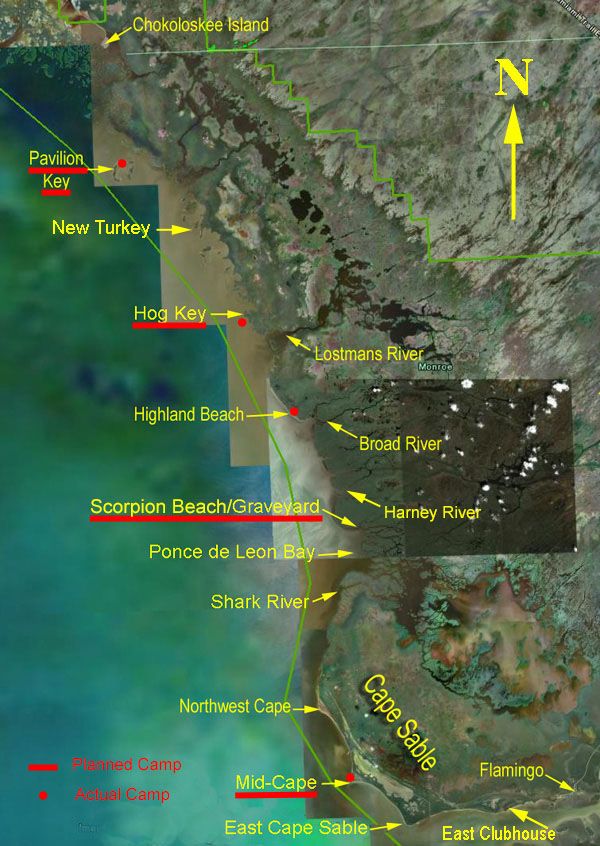
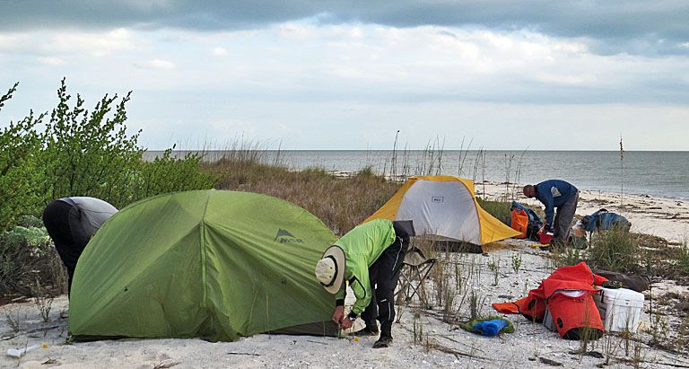
Our trip tic included the usual campsites: PAV, Hog, Scorpion, and MidCape. Our stops at PAV and Hog included fishing days. Foul weather, very foul, forced us into Highland Beach. So, the next day, we had a lengthy, straight-line run of 23 mi from HiLand to Northwest Cape and around to MidCape. Wild ride, but we did it.
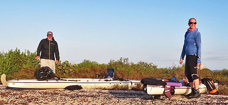
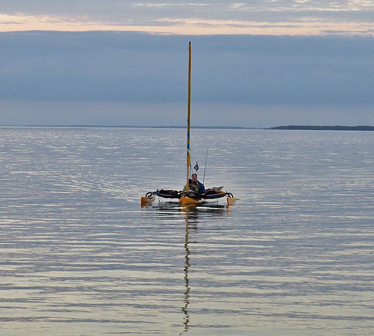
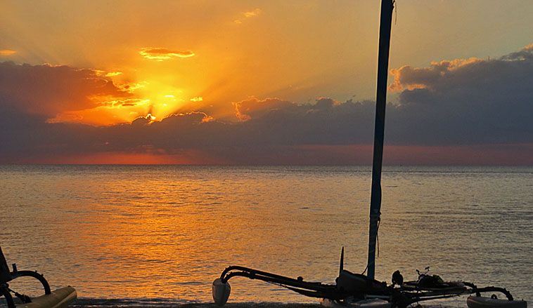
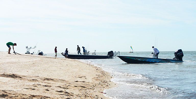
This is a WaterTribe group, so we met and left people in the beginning. Here, Royd and I are ready to launch from the Chokoloskee Causeway. Because of the tides, we arrived at Pavilion Key an hour before sunset.
Toby Nipper and his “boot camp” group greeted us on Pavilion. They were in kayaks and had left earlier in the day. Whitecap’s group does not hang around long, and they left early the next morning. Here is Toby and Libby Wolf. Libby considered doing our trip, but she would have been the only kayaker (or maybe she looked at the weather forecast) and opted to do a loop with Toby.
Royd with DolphinGal (Kathy Kenley).
With Toby leading the way, they head out to “parts unknown.” It is very difficult to pin Toby down about where he is headed. Maybe he does not know for sure.
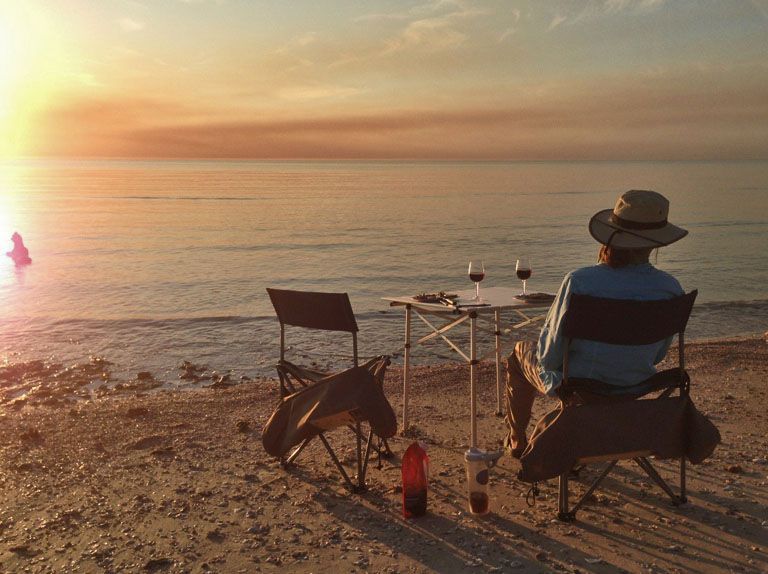
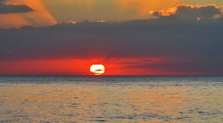
Royd and I did some fishing and had fish sandwiches for dinner. We are never short on beautiful sunsets.
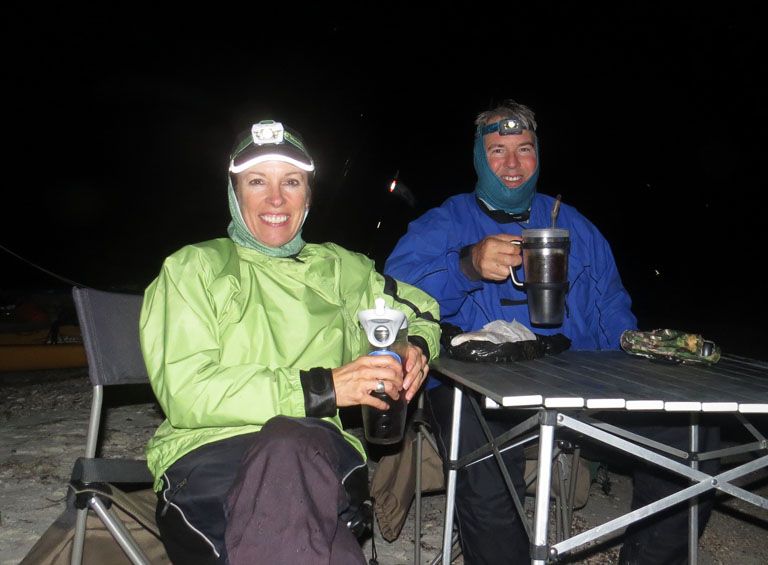
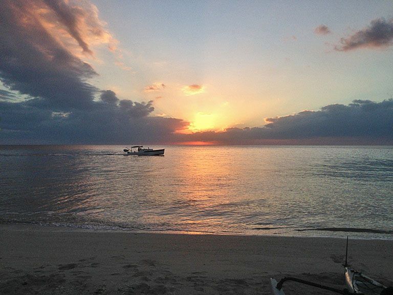
After sunset, Debbie and Tom came in. They pedaled much of the 9.5 mi from Chokoloskee.
They know how to relax after a tough day.
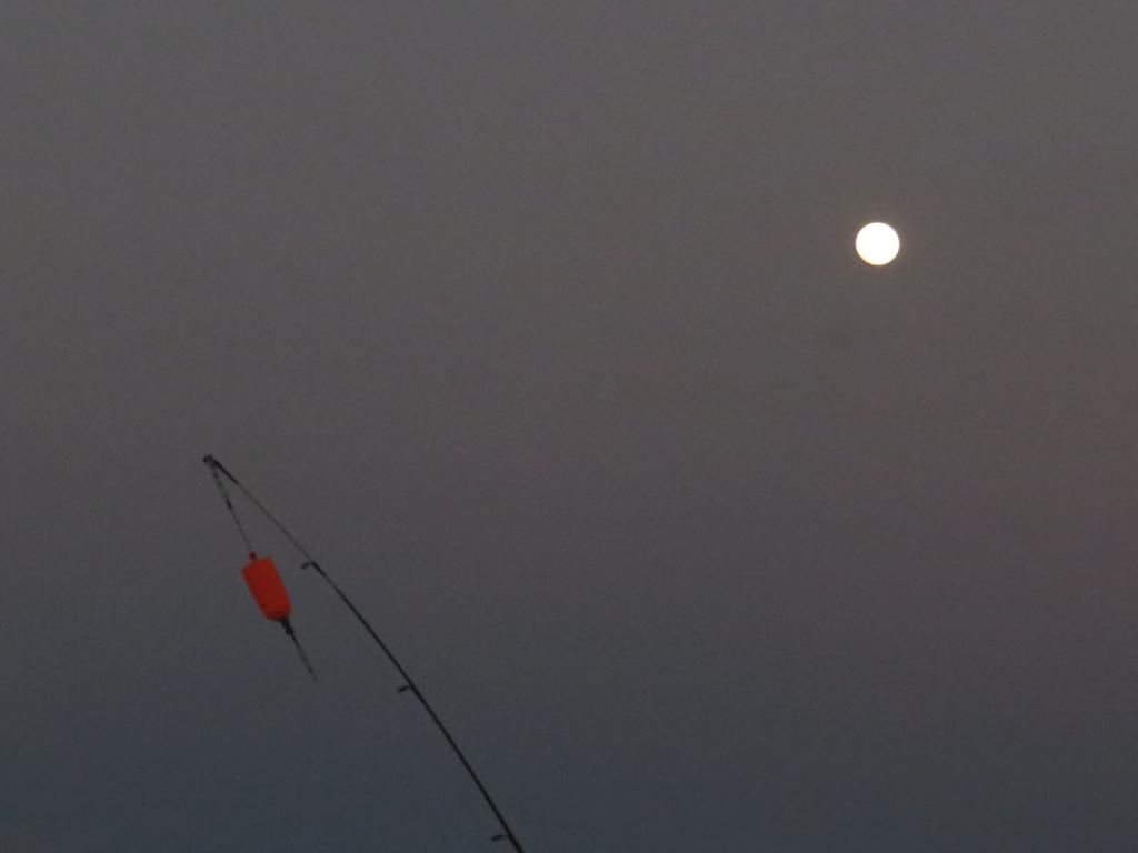
We had 2 nights in succession with a full moon.
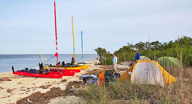
Royd is definitely in the WT tradition of up and out early. When we have enough water, we will head to Hog Key.
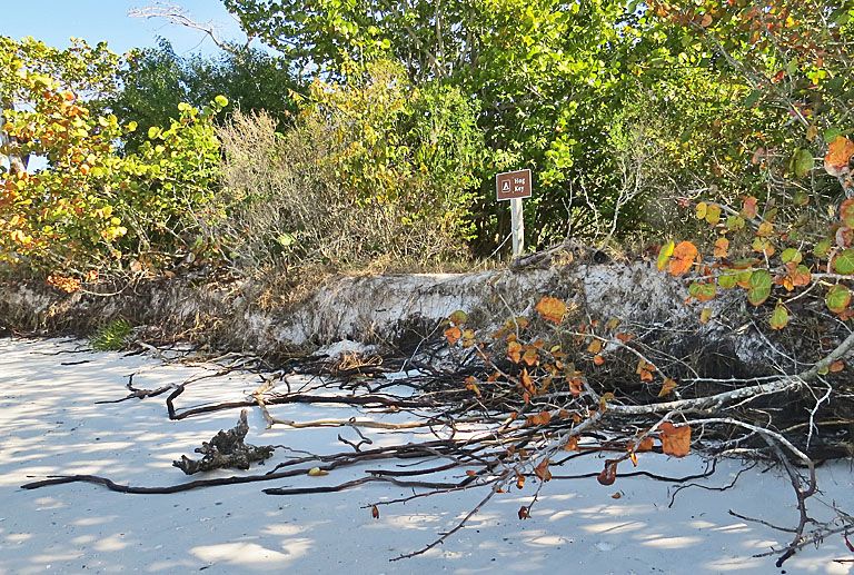
Having fun on Hog Key.
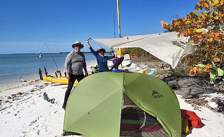
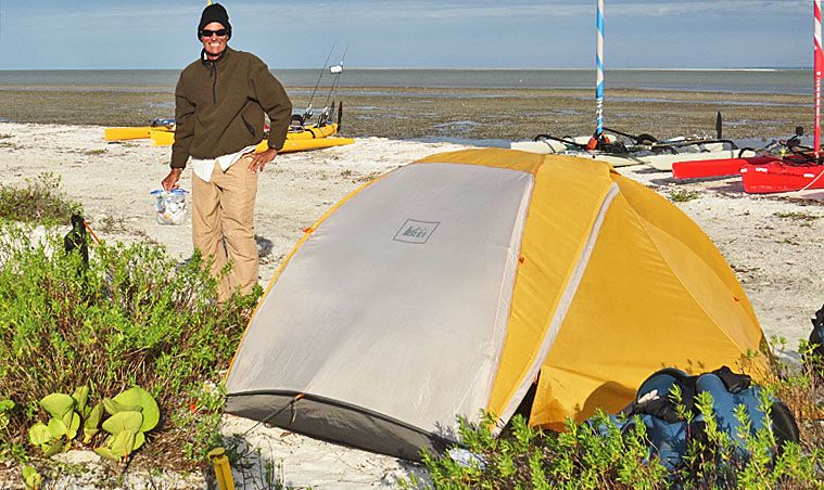
Hog Key camp. I’m in the middle here. I’m so relaxed, I haven’t gotten around to put up my tent yet.
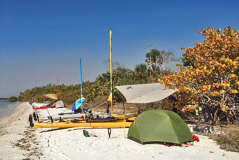
Royd’s camp
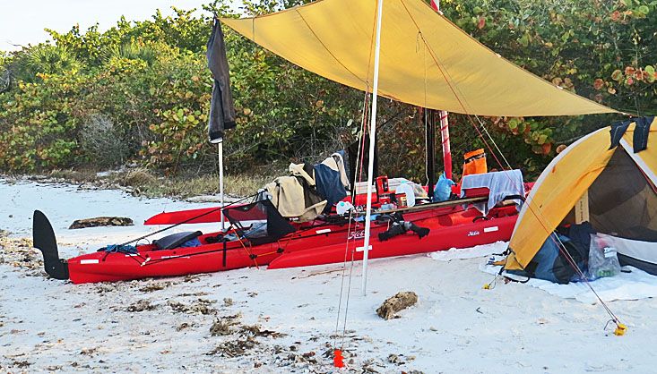
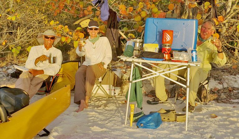
These WaterTribers know how to unwind.
Later, Tom got this picture as he & Debbie were having a seaside dinner. Nice.
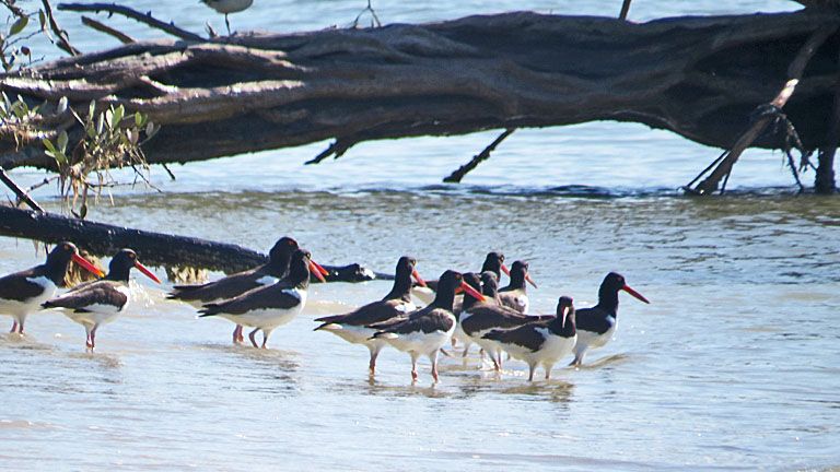
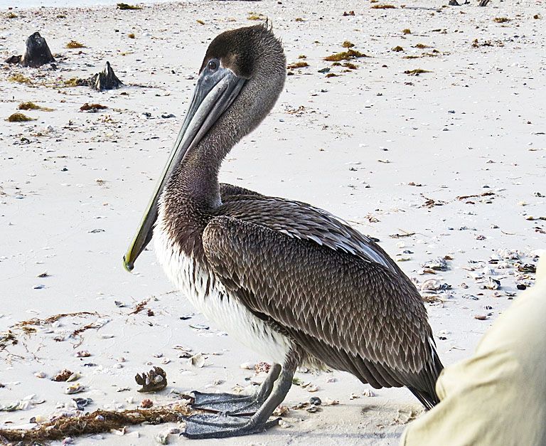
The first oystercatcher I ever saw was in Alaska. I was surprised to come back to FL and see them here. This flock was at the end of our Hog Key beach.
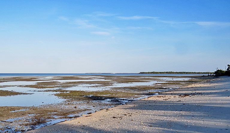
Low tide at Hog Key. This is a fishing day. Where are the fish? Over by Wood Key which is middle right in this picture.
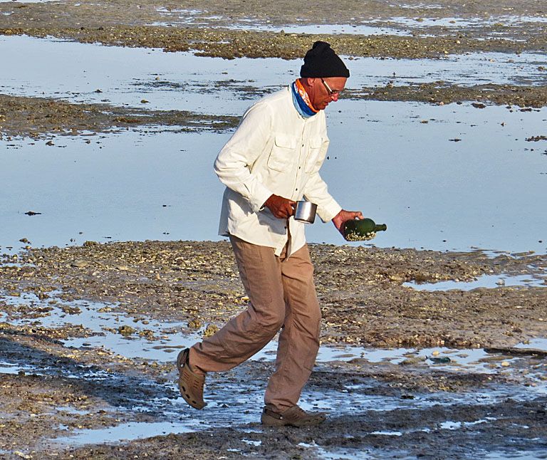
Royd, coffee in hand, is working the flat. Looks like he's found a great barnacled bottle. Is there a message inside?
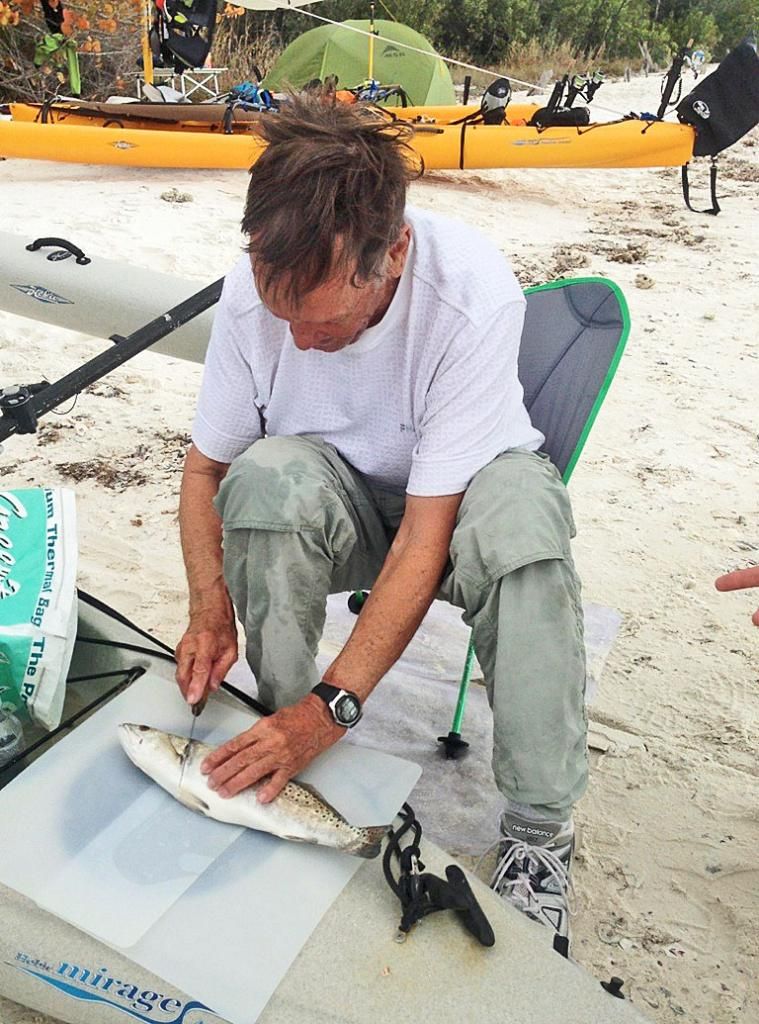
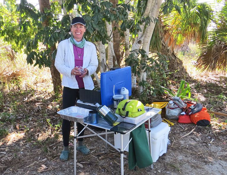
We all share in the on-shore duties, and I was lucky to have these strong WaterTribers with me. They often hauled my AI up/down the beach. Me, well, I did the things I was best at: catch and clean fish.
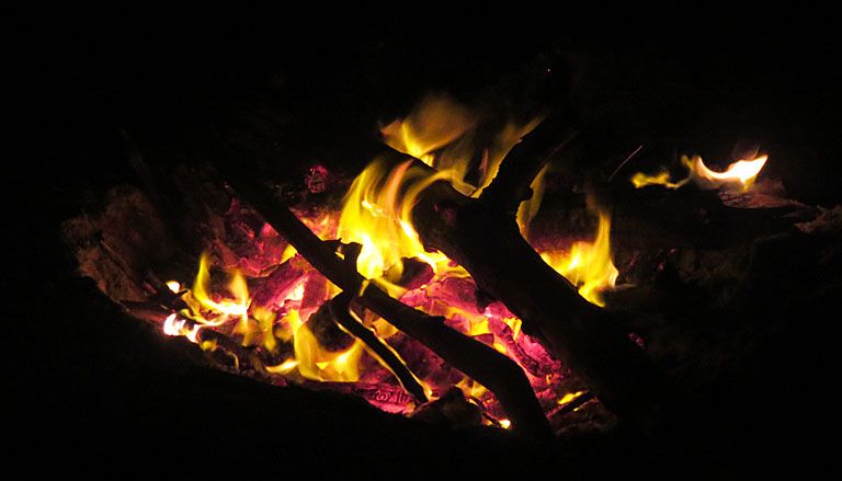
I’m not a fan of camp fires, because most campers don’t follow the rules. If you have a fire, dig a pit below the high tide line and (my rule) avoid despoiling the beaches with partially burned wood. So, this is a new one for me. Our dinner guest looks on.
Yeah, it’s me. Believe it!
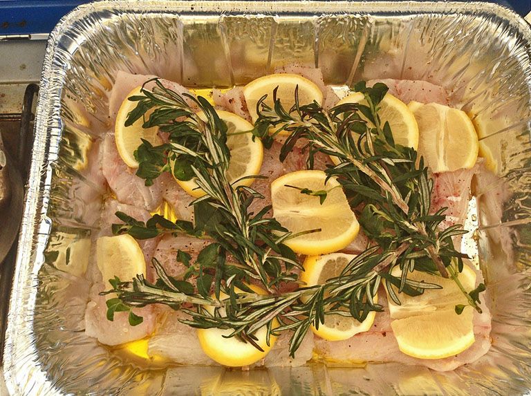
In the meantime, Debbie and Tom were whipping up a delicious dinner. Sea Trout filets with spices, thin sliced lemon, and sprigs of fresh Rosemary ready to cook on Tom’s stove. That fish with Idahoan "Butter & Herb” mashed potatoes—yes, the one’s Rene Potvin thinks I have a fetish about—was spectacularly delightful. I woke up the next morning thinking about it.
Our dinner guest enjoyed any tidbits, we gave him.
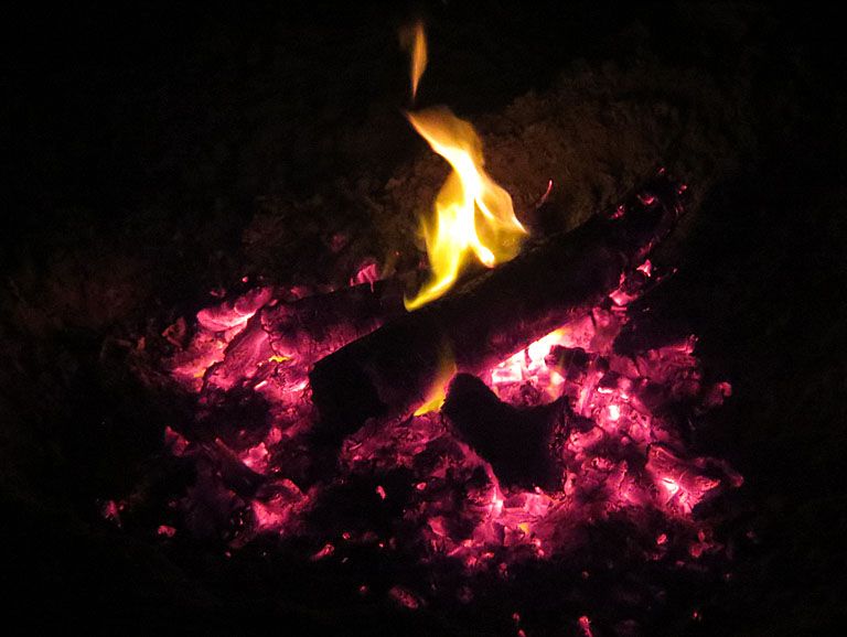
After dinner, we enjoyed a nice fire.
In 2011, four of us camped at this site, up in the mangroves because the tides were high. It was Jon New, Rick Parks, Rene Potvin, and me. In amongst the vegetation, the mosquitos were absolutely horrendous.
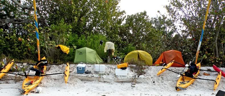
Now it is badly overgrown and the shore is further eroded. From the pictures above, however, you can see that we can still set up a nice camp. It might get a little tight at high tide, and I’m always thankful I’ve never had a rogue wave or tsunami come in when camped here.
On Day 5, it was our plan to travel about 15-16 mi down to Graveyard/Scorpion Beach. The long range forecast had predicted south winds of about 10 mph. When we get a “cold” front coming in, winds always come around counterclockwise from the E to S to W to N, and back to E. Well, there was a cold front coming in, and it apparently arrived a day early.
With this group, nobody was listening to their VHF radios for the weather forecast. When I was sea kayaking, I didn’t worry about it because you got up every day and looked at the weather. Pretty straight forward. Still, usually somebody or several are monitoring the weather. Not this group. It is probably a characteristic of WaterTribers. They push forward no matter what the weather or conditions. The weather will be what it will be.
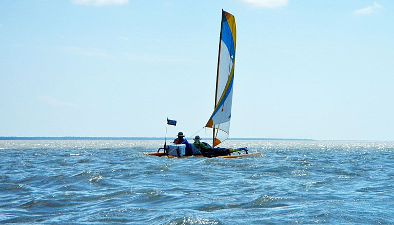
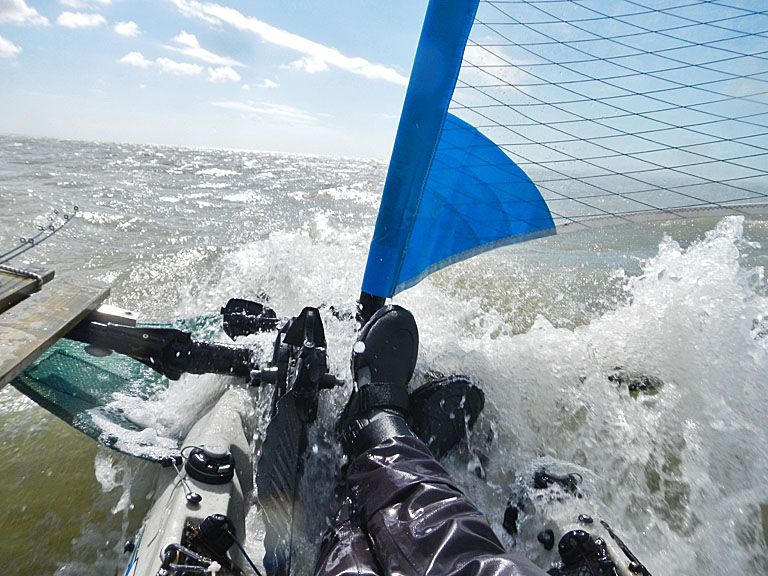
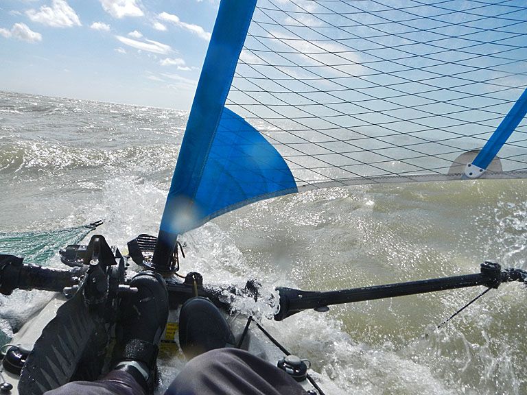
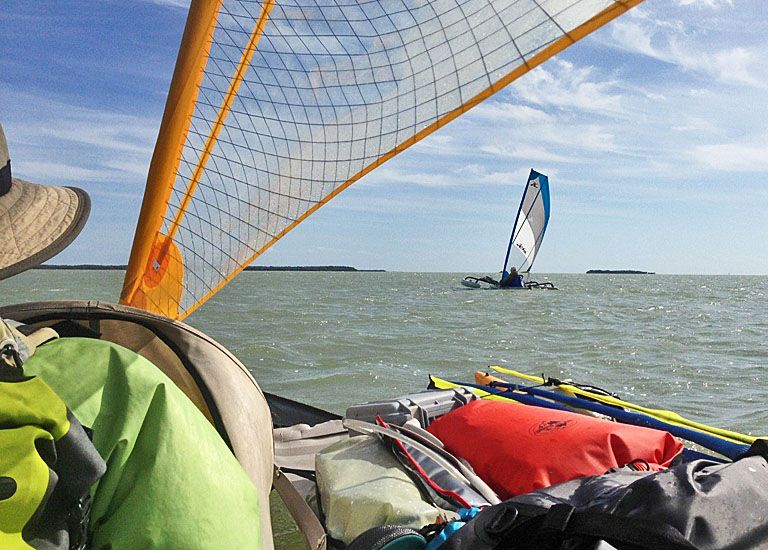
On this day, we left Hog as early as the tide permitted, and before long we were in rough seas with westerly winds in the 20-25 mph range. We were on a beam reach. Here is Royd off my starboard. Notice that his sail looks to be 60% or more furled.
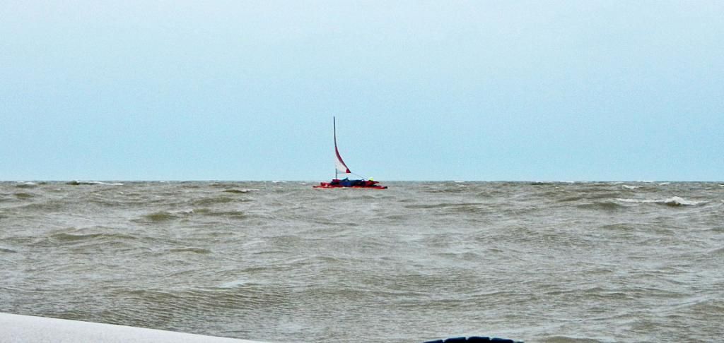
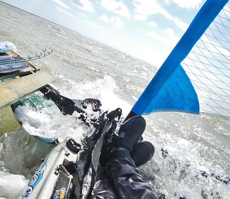
It was a very rough day on the water. I’ve sailed in stronger winds (up to gale force coming off land), but never in rougher seas. From Hog to HiLand, we had the strongest winds of the trip. Probably in the 20+ kts range (ca 23 mph and more) with higher gusts. Straight out of the west. One huge wave washed over my head, and I had water up my nose, in my mouth, and couldn’t see. I didn’t know if I had capsized or not. When I cleared my eyes, I was still upright.
On our radios, I told Royd & Tom that we would abort going to Scorpion Beach. Instead, we would go into Highland Beach. In December of 2013, about 50 pilot whales stranded themselves on HiLand. It is remote. At least 10 died before they were turned around and headed 20 miles to deep water.
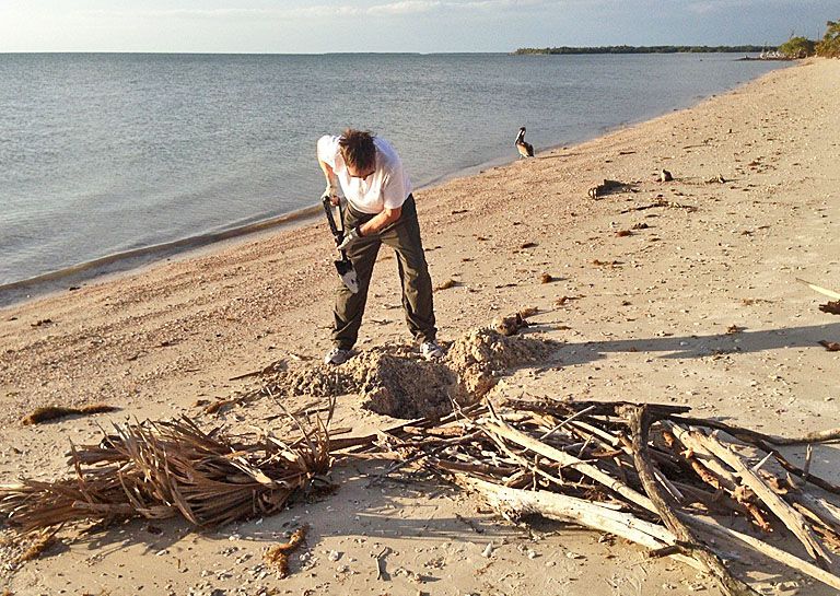
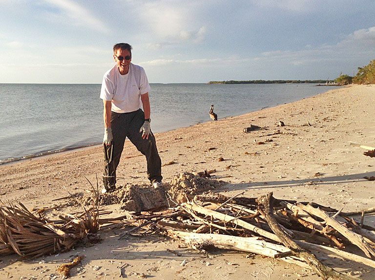
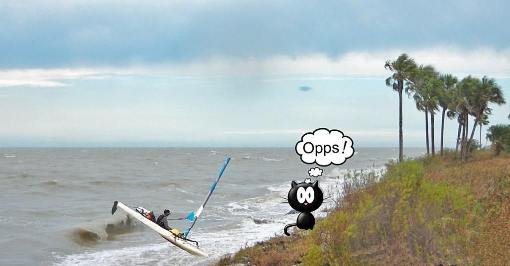
Shortly after I made the decision to go to HiLand, Tom radioed that they were going into shore a few miles south of Lostmans River, because their furling drum had slipped and needed a fix. They were about 3 mi from the HiLand camp. I told them that Royd and I would go to our camp, and they would see our boats along shore. You may know, when you get in difficult situations like this, time seems to slow to a snail’s pace. Finally, Royd and I made it, but only after I did a surf landing. I posted a note about it earlier. In case you did not see it, I’ve copied it here.
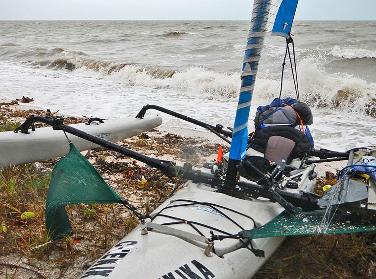
Chekika wrote: Stuffed on an Everglades beachDuring last week’s week-long trek in the Everglades along the Gulf coast, we had fierce winds for 3 days. The worse was when we traveled from Hog Key to Highland Beach. My estimate of those broadside winds was about 18-22 kts (21-25 mph) with higher gusts. Going into my favorite site on HiLand, I furled the sail, took the pedals out, and allowed the strong wind to carry me directly onto the beach. The rudder controlled the boat nicely. The beach slanted to the water at gentle 10-15 deg angle. As I neared the beach, a wave lifted the back of my boat up and stuffed me, bow first, straight into the beach. BAM! Dead-stop! I was shocked. As the wave receded, I coasted onto the beach, jumped off, and pulled the boat up. Fortunately, I was going straight in and did not broach, otherwise, the akas might have suffered serious damage. Not surprisingly, the rudder pin was broken—light damage for a potentially catastrophic landing. HiLand is about 40 miles from the nearest marina and help. I’ve been in higher winds, but those were the roughest seas I’ve ever sailed my AI. It should have dawned on me that I was about to do a surf landing, but we all know that one does not have to worry about surf landings along the Everglades Gulf coast. The following picture was taken after the landing. No one was there to take my picture so I had to make up my boat portion, but I think it is a pretty good likeness of my landing. My friends, Royd Whedon and Debbie and Tom Turner, arrived shortly. Their landings were quite normal and without incident.
Keith
Here is a quote from an email message from Royd:
Royd Whedon wrote: Keith, I was watching the whole thing from directly behind you on the water. And, I must say, that that is a very good representation of the event. You did, in fact, STICK that landing. What a hoot. Royd
These are the seas that we were sailing in.
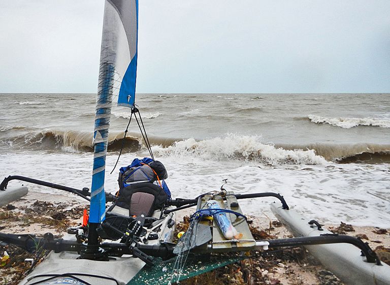
More dumping seas
View to the south of landing site
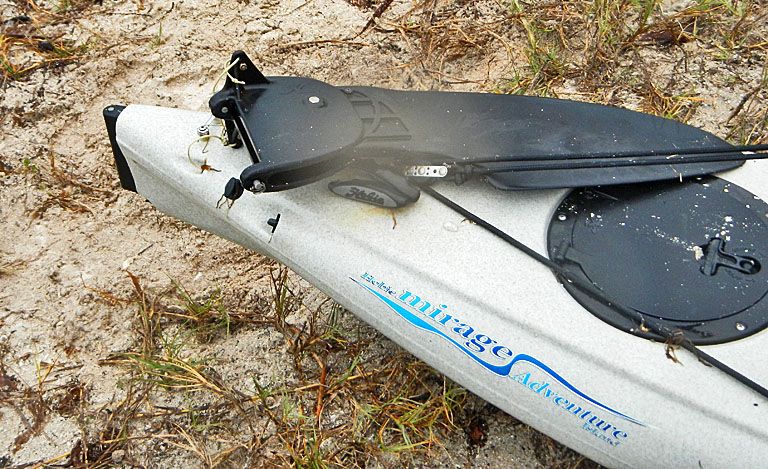
A broken rudder pin was the only damage my boat suffered.
Royd and I worried when we did not hear from Tom & Debbie. I had my VHF radio tied high on a palm tree with the volume up, but heard nothing—the winds were howling. Still, I thought I would hear any call that came in. Both of us, from time to time, tried to contact Tom & Debbie without luck. But, out of the clear blue (perhaps I should say gray,) there they were coming along shore. They landed without all the heroics of my landing. We were all quite happy.
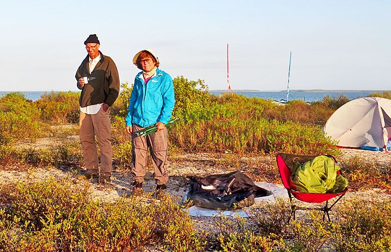
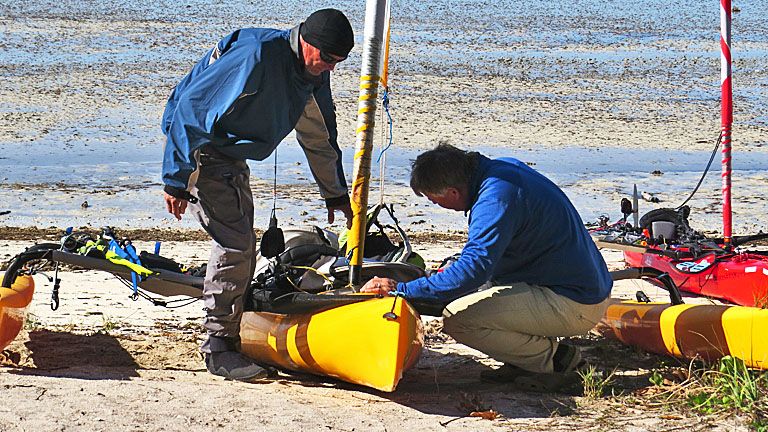
Next morning, Royd & Tom check the furling drum. Low tide at HiLand, so we’re not going anywhere soon.
Debbie enjoying the shade at our HiLand site.
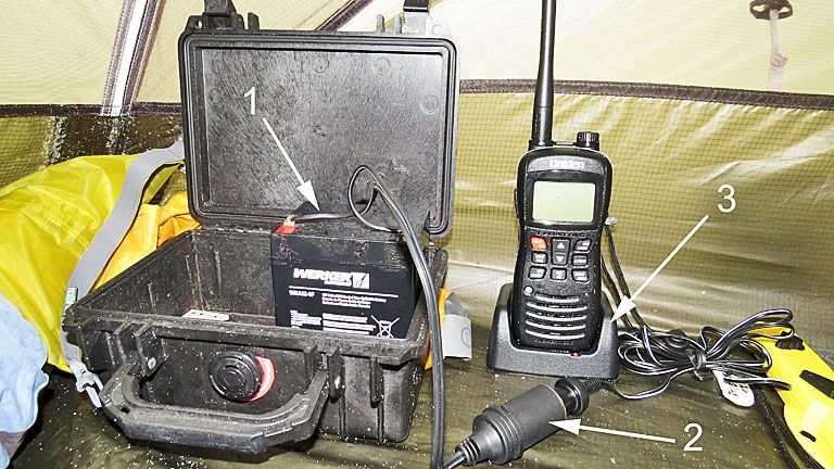
On the 5th day, my Uniden VHF radio battery dropped from 5 to 4 bars. I recharged it that night with my charging system. It consists of a 12-volt battery (1), attached cigarette lighter receptacle (2), and anything, e.g., my VHF radio charger (3), that can be plugged into the cigarette lighter receptacle. My radio was charged by morning. I also put USB plugs into the lighter receptacle for charging phones, tablets, and camera batteries.
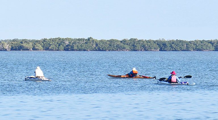
Tom & Debbie and I left HiLand about noon on the 6th day; Royd, as usual, was 30 min or more earlier. During the night the front had worked around so that the strong wind was out of the north, maybe a little NE. It was perfect for the downwind run 18.5 mi south on a line to Northwest Cape Sable and then 4.5 mi SSE to MidCape. I asked Tom how he was navigating. Was he using routes on his gps? Without hesitation, he responded, “No, I use the IFK method.” Puzzled, I asked, “The IFK method?” Tom, “The ‘I Follow Keith’ method.”
With the winds 16-18 mph and gusting higher, it was going to be another wild ride. Here I am rock‘n and…
…roll’n
…with some diving mixed in.
We made the 23 mi trip from HiLand to Middle Cape Sable in 4 hrs—a fast and fun run. No boat problems. Here my friends are on MidCape—busy, busy, busy.
Late afternoon on MidCape
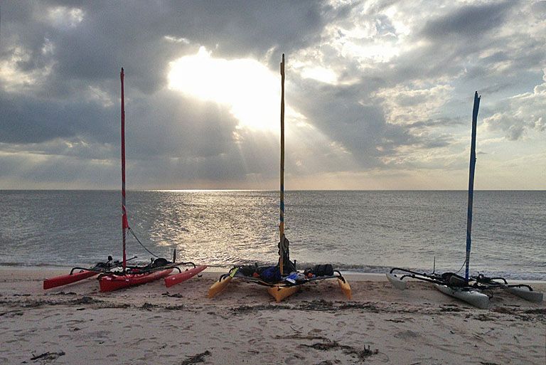
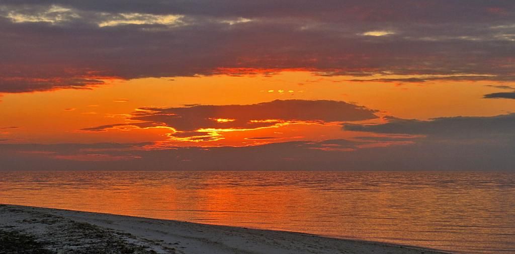
Sunset on MidCape
And, that is how our last evening ended.
Debbie & Tom enjoying an early cup of coffee.
As we head out about 11 AM, the power boaters, from the south-facing shore of MidCape, anchor their boats around on our side to prevent the strong easterly wind from beaching their anchored boats. A few years ago, when a similar group of boats were anchored on the south side, a strong storm came through. Two boats, which were not anchored sturdily enough, washed up on shore, filled with sand, and were crushed. These folks are not going to have that happen.
The winds were 17-19.5 mph easterly, gusting to 22-24 mph, as we beat on our way to Flamingo. These winds were recorded at a weather station about 3 mi south of East Cape Sable.
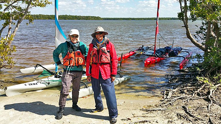
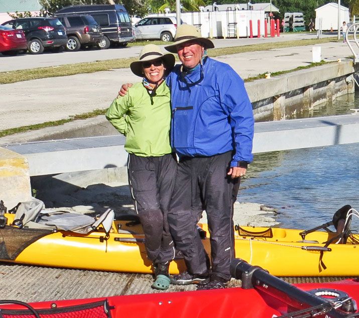
Flamingo. Debbie and Tom, a week in close quarters and happy as 2 peas in a pod.
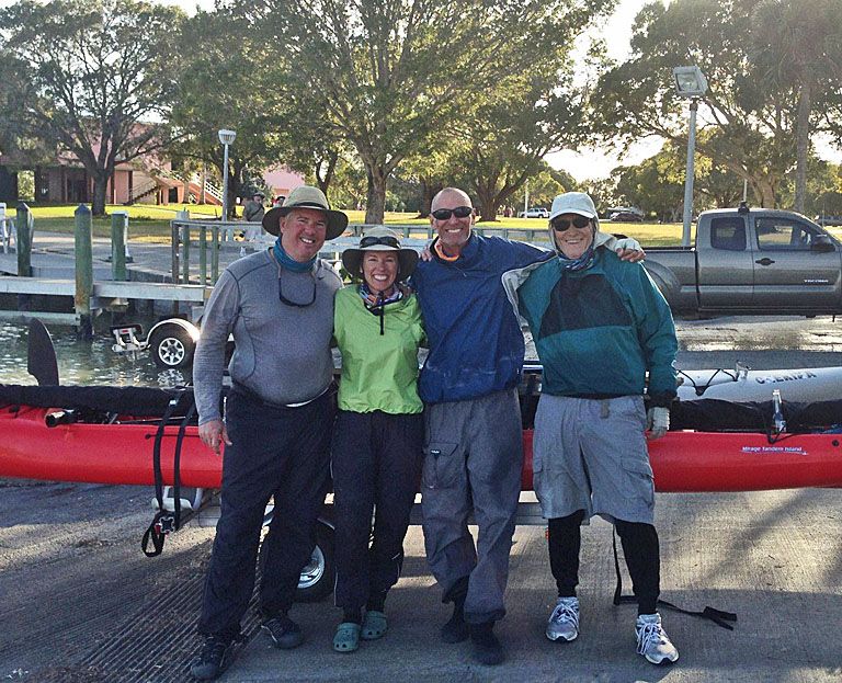
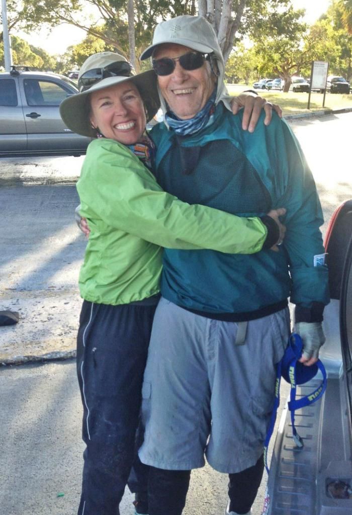
The whole group is happy! "Thanks" to the friendly raccoon who came by and took this picture.
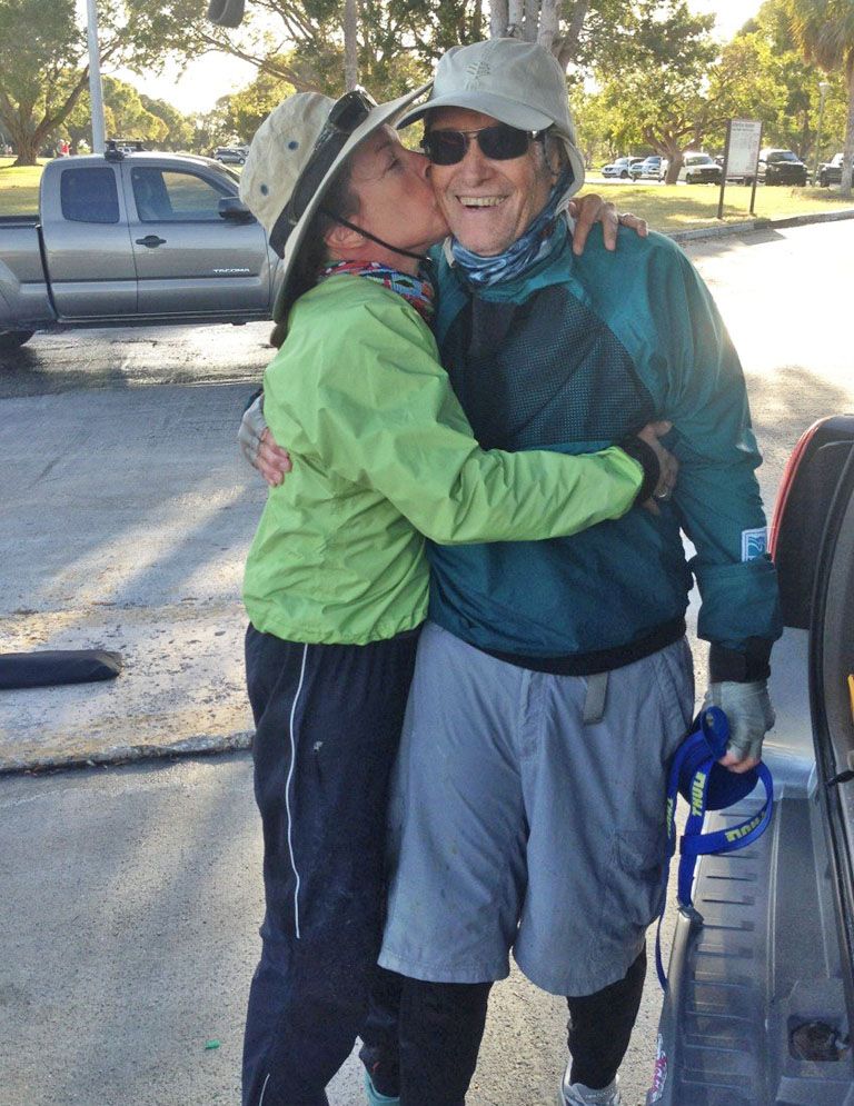
Debbie giving me a hug. She is sweet…
and sweeter!
Fun trip. The best!
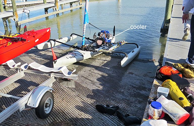
A little puzzle. Each of the last 3 days including at Flamingo, I would empty 1-2” of water out of my 14” high cooler at the end of the day. The cooler only has a top opening. I wondered where it came from. What do you think?
Keith
_________________
2015 AI 2, 2014 Tandem
"Any intelligent fool can make things bigger and more complex ... It takes a touch of genius and a lot of courage to move in the opposite direction." A. Einstein
"Less is more" Anon
|
|