Return to Hobie.com
Hobie Forums
It is currently Mon Sep 08, 2025 1:15 pm

All times are UTC - 8 hours [ DST ]


Post new topic Reply to topic  [ 11 posts ] 
Author Message
PostPosted: Thu Jul 30, 2015 3:41 am 
Offline
Site Rank - Captain

Joined: Mon Jul 21, 2014 6:56 am
Posts: 39
Location: Tampa, FL
Hello fellow islanders,
I've recently purchased a 2015 TI, huge improvement from my 2010 AI! I've decided to start a sailing log book using Excel. I'm also considering purchasing an app for my iphone. I'm looking into an app called wavetrax. Does anyone else use such an app? If so, are you happy with it? or what other sailing log apps are popular?
I don't currently have a GPS yet but I'm researching those too. Would it be better to use a GPS then download the data for a log book?
I would appreciate any input on this,
Thanks,

John

_________________
2015-Tandem Island


Top
 Profile  
 
PostPosted: Thu Jul 30, 2015 4:52 am 
Offline
Site Rank - Old Salt

Joined: Sun Apr 20, 2008 6:18 am
Posts: 3062
Location: Sarasota,Key West FL
We also have a TI, I have a really cheap Garmin E-trex that I wear around my neck, it gives me speed, direction, average speed, and distance traveled. That's typically all I need, I like this unit because it has held up for 3-4 yrs now with no issues in salt water, and has great battery life. The previous way more expensive 5 or 6 Garmins I had with every feature imaginable (most of which I didn't use) all failed in about 6 months I assume because of the salt water (I literally have a drawer full of them).
I also have an I-phone with a lifeproof case that I carry in my shirt pocket with several apps installed. Most of the guys are using the Navionics app and like it. I have an app called I-sailer from transas. I-sailer has live on screen current chart info with all the channel markers and depths, very useful up around Anna Maria Island in that maze of shallows with very narrow channels that are impossible to tack in. I also use it around Key West which is the same way, too shallow everywhere except in the really narrow channels on the West side.
One cool feature is course plotting that can be exported to google earth (I suspect exactly what you are looking for).
Another cool feature is you can pre program course waypoints and it displays pretty good info enabling you to follow programmed courses though I seldom use that feature.
Another really cool app is from Dash software that creates dashboard overlays on your videos showing real time speed, course, direction, or anything else you want displayed on your videos via overlays (cool stuff, and it's free). Works with any camera, I have a GoPro (disclaimer: all my video's are all really boring (lol)).
I also use Pandora when out, keep up with business emails, facetime with the family, and have done business video conferencing all while out on the water (pointer about video conferencing...turn off your camera (audio only), and furl your sail otherwise a dozen people will be on to what you are really doing (true story lol). I also have a wrist strap for my I-phone which is pretty handy.
I also have an I-pad with a lifeproof case and all the same apps, but seldom use it because it's rather bulky.
Hope this helps
Bob


Top
 Profile  
 
PostPosted: Thu Jul 30, 2015 8:29 am 
Offline
Site Rank - Captain

Joined: Tue Jul 10, 2012 10:22 am
Posts: 63
I have "Motion X-GPS" on my iPhone, but I have found that it, as well as other GPS apps, are real battery hogs. Also, big wet sausages for fingers + lifeproof case + moving boat + small screen + general lack of fine motor skills = hard for me to operate on the water.

I have a Garmin GPSMap 78. I like it because it floats, is waterproof, portable, easy on the batteries, has lots of interesting functions, including a speedometer. You can save your tracks and other stats on the unit. It has a mini (maybe micro) USB port. However, I am not sure how well it interfaces with a computer and other programs, just because I have never tried to download any data off of it. They run about $200.00.


Top
 Profile  
 
PostPosted: Thu Jul 30, 2015 9:57 am 
Offline
Site Rank - Captain

Joined: Thu Nov 20, 2014 12:38 pm
Posts: 31
Location: San Antonio, TX
I use Google's "My Tracks" on my Galaxy S5 phone.

Simple, but no bells and whistles.

_________________
2012 Hobie Kona
2014 Hobie Tandem Island


Top
 Profile  
 
PostPosted: Thu Jul 30, 2015 10:20 am 
Offline
Site Rank - Old Salt

Joined: Tue May 18, 2010 2:31 pm
Posts: 3068
Location: Kailua 96734
Navionics.

_________________
The Wind Is Your Friend...


Top
 Profile  
 
PostPosted: Thu Jul 30, 2015 11:17 am 
Offline
Site Rank - Captain

Joined: Mon Jul 21, 2014 6:56 am
Posts: 39
Location: Tampa, FL
Thank you all for the input. I will check out Navionics and I-sailer for the Iphone but I'm worried that any app will suck battery life, I do however have a portable solar charger (I use for camping) but its's not waterproof.
As far as GPS, I've looked at the Garmin 78sc, I like it, but it's a little pricie right now. I'll look into the e-trax, I think those are cheaper. Fusioneng, I see you're located in Sarasota, I'll have to come down and do some sailing with you someday. I've only had the new boat out twice in 6 weeks of ownership (busy with school and weather has been horrible).

Thank you again

John

_________________
2015-Tandem Island


Top
 Profile  
 
PostPosted: Thu Jul 30, 2015 11:54 am 
Offline
Site Rank - Old Salt

Joined: Sun Apr 20, 2008 6:18 am
Posts: 3062
Location: Sarasota,Key West FL
John:
No kidding about the local weather, It's been a month now of constant rain every single day. I usually launch down at City Island down in Sarasota (right next to the Sarasota Sailg Squadron and Mote Marine. It's a great place to launch from and many AI/TI's from the area launch there. I'm usually their every saturday (my wife has to work Saturdays, she works at a store close to there on St Armond circle), so I'm usually out bumming around with nothin else to do. The other really popular area we like to go is Ft Desoto and Egmont Key, Tons of Islanders there pretty much every weekend.
There are a couple active Hobie Island clubs in the area, that get together every few months.
Bob


Top
 Profile  
 
PostPosted: Thu Jul 30, 2015 12:19 pm 
Offline
Site Rank - Old Salt

Joined: Wed May 25, 2011 3:15 pm
Posts: 611
Location: Buffalo, NY
I use the following for a "GPS"

1) a waterproof phone pouch: http://www.amazon.com/gp/product/B005LN ... ge_o02_s00
2) Two (free) GPS apps:
“Speedometer Maps and Tracks” by Yadvinder Mann records top & avg speed, total distance and time, and records your track. (Hit "play" to start GPS, "pause" to stop and "record" to save)
“Sailboat GPS Tracker and Data Logger” by Ndili Technologies, Inc, records your track with metadata - you can click on any part of your track and find out what your speed and course were at that location and time. It does not explicitly tell you your max speed, average speed or distance (hence the two apps), but it does allow you to review your track overlaid on google maps and share your track online!

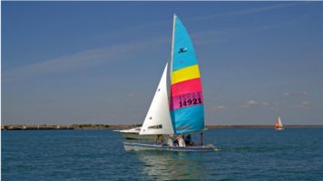
For example, a few weeks ago I used the first app to record a top speed of 14.17 mph, distance of 12.61 mi, avg speed of 7.03 and time of 1 hr, 47 mins, 34 seconds on one outing.
I used the second app to record the track: http://n1.ndili.com/NTechWeb/r/1IN95ZRCCA42/tracks/en

I don't go out without starting the GPS anymore, it's too much fun seeing what my top speed was at the end of the day! I don't use it at all while sailing, but I like taking a look afterwards. I find the track interesting to review - you can see where you hit consistent geographical wind shifts, or if the wind was veering or hauling consistently. Though really, I'm just happy to see what my max/average speed is after each sail, and I'm always surprised to what my total distance is. Last weekend I covered 40 miles in four hours!

GPS apps are inherently battery intensive, so I'd suggest getting a backup battery (as I have) for your phone to keep it from dying on you!

_________________
Mike
Image
'79 H18 standard 'Rocketman II' sail #14921 RIP
'78 H18 (unnamed) sail #14921
'08 H16 sail #114312
'97 H21SC sail #238


Last edited by SabresfortheCup on Thu Jul 30, 2015 1:10 pm, edited 1 time in total.

Top
 Profile  
 
PostPosted: Thu Jul 30, 2015 12:45 pm 
Offline
Site Rank - Old Salt

Joined: Sun Apr 20, 2008 6:18 am
Posts: 3062
Location: Sarasota,Key West FL
I just had a startling revelation about GPS's
I always talk about going thru a lot of GPS's, and they seem to last about 6 months on salt water, then their done.
The GPS my wife always recommended to me was always the Garmin Etrex legend (she is into geocaching and that's what she always used and was very happy with it. I just checked, that's a 'hiking' GPS and isn't waterproof (boy am I embarrassed, I have 4 ruined ones in my drawer).

The last GPS I bought about 5 yrs ago was a yellow etrex that I bought at West Marine for I'm positive around $50 bucks. It's the base base monochrome model with virtually no features, the darn battery lasts forever, and it's been in the water and soaked pretty much every weekend since.
Reading this post got me thinking, maybe I should get a new GPS myself. Holy moly are they expensive, I had absolutely no idea, haven't even looked at any for 5 yrs now. I'm now going to go clean my old garmin yellow cheapie one (that they apparently no longer make) and hope it lasts a few more years.
I have a replacement plan on my I-phone where if anything happens to it I get a new one for $30 bucks, I'll just be using my I-phone once that Garmin dies.
Bob


Top
 Profile  
 
PostPosted: Thu Jul 30, 2015 5:11 pm 
Offline
Site Rank - Captain

Joined: Mon Jul 21, 2014 6:56 am
Posts: 39
Location: Tampa, FL
fusioneng, thats funny, that you have a drawer full of GPS's that don't work because of being non-waterproof. I started researching the etrax after you suggested it and I noticed Garmin didn't say they were waterproof. I think I'll stick to my original GPS that I want, the 78sc. Waterproof and floatable! Currently $250 on thegpsstore.com, lowest price I've seen. For now I will get an app for iphone (testing Navionics and isailor free versions) until my wife lets me spend $250.
I'm thinking maybe first or second weekend in August to come down to Sarasota for a day of sailing, it's between school semesters. I'll send you a message when I nail down a weekend. Yes there is a group that sails around here, Watertribe, which I'm a member through Meetup. I've sailer with Chief out of Fort Desoto and Dunedin Causeway. I will eventually do the EC challenge but after reading this past years debacle, I'm not ready. I need more practice and ALL the proper gear.
My wife also puts a blog together about our adventures if you're interested: https://yakaholics.wordpress.com
John

_________________
2015-Tandem Island


Top
 Profile  
 
PostPosted: Thu Jul 30, 2015 9:28 pm 
Offline
Site Rank - Deck Hand

Joined: Sun Jul 12, 2015 7:20 pm
Posts: 20
I use an iphone app called 'Checklist' for my preparation checklist- works great. I also have an app called 'Dashometer' that gives me a speed and bearing readout in realtime. It's supposed to also be able to track a route, but I haven't gotten that working yet. I store my iphone in a clear tupperware container. Dashometer has big bold text so it's easy to view through the waterproof holder.


Top
 Profile  
 
Display posts from previous:  Sort by  
Post new topic Reply to topic  [ 11 posts ] 

All times are UTC - 8 hours [ DST ]


Who is online

Users browsing this forum: No registered users and 2 guests


You cannot post new topics in this forum
You cannot reply to topics in this forum
You cannot edit your posts in this forum
You cannot delete your posts in this forum

Jump to:  
© Hobie Cat Company. All rights reserved.
Powered by phpBB® Forum Software © phpBB Group